Is Lake Eyre going to flood?!
By Nick Stobie - Touring Pilot
About a dozen or so times a year, Jarrod or David in the tours office come to me with questions about Lake Eyre. More often than not, a guest is interested in booking one of our trips to visit Lake Eyre, but they want to know if the lake is 'in flood' and if they'll see it with water. Invariably my answer is 'it's complicated,' followed by me jumping on the phone to have a chat with said guest, something I really do enjoy - sharing a passion I have for some really unique parts of the country.
Here's what 'major flooding' looks like on Lake Eyre - a satellite timelapse I put together of the 2009-2011 period over the lake.
On my 'to-do' list for a while has been to write a bit more about how Lake Eyre floods, so here we go.
There are a few things to be understood about flooding and Lake Eyre. They are:
- What is the Lake Eyre Basin?
- Where all the water comes from
- How floodwater gets to Lake Eyre
- How Lake Eyre itself floods, and how we measure that flood

What is the Lake Eyre Basin?
Most Australians have heard of Lake Eyre - when full, it's the largest lake in Australia at some 9500 square kilometres. Its lowest point is 49ft/15m below sea level, and most of the lake is below the sea level datum.
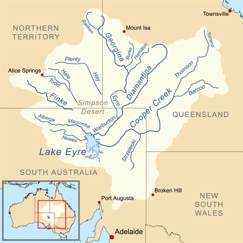
The Lake Eyre Basin is a little less known. The basin is the catchment area where water will naturally flow through to Lake Eyre. You can think of it like a sink. Lake Eyre is the drain at the bottom (permanently plugged), and the basin is the entire expanse feeding water into that plug.
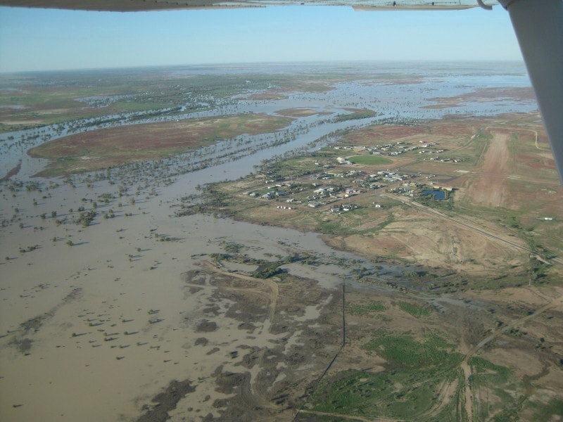
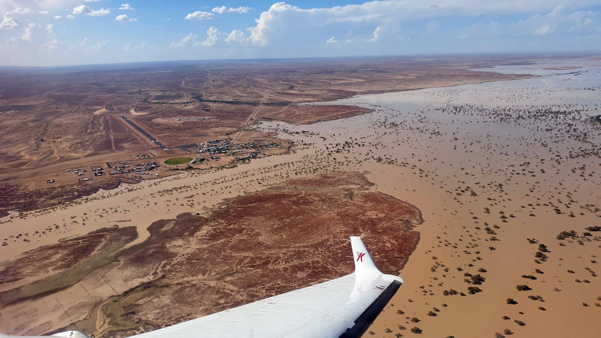
The basin extends up into the Northern Territory and south-western Queensland, with some points in the basin more than 1000km away from Lake Eyre itself. Despite this vast distance, the vertical fall between the edge of the basin and the low point is only approximately 200m, making the basin incredibly flat. As a result of this, flood water often travels slowly and spreads out into lagoons and lakes that can be kilometres across.
Where does the water come from?
Floodwaters
If we understand the Lake Eyre Basin, we understand that the water flowing into Lake Eyre is often flowing from rainfall over 1000km away from Lake Eyre itself. During the summers, Queensland and the Northern Territory are routinely battered by tropical cyclones. As these systems make landfall, they typically decay and become tropical lows, bringing warm moist air and heavy rain inland - often as far as western Queensland or the southern parts of the Northern Territory. These often cause flooding in the north of the Lake Eyre basin, and this water migrates south and heads towards Lake Eyre.
Because of the relatively flat terrain, the water moves slowly and can take several months to make the journey. Of course as it moves through the landscape, several things can happen to this water that may prevent it from all reaching the lake itself.
Evaporation is one of the major losses of water in the Lake Eyre basin. Temperatures across the summer period are routinely above 40 degrees, and with the exception of tropical weather systems - the humidity is normally quite low. These conditions equate to high evaporation rates.
The terrain itself has often been dry for an extended period, and so some of the water is also lost into this terrain.
Local rainfall
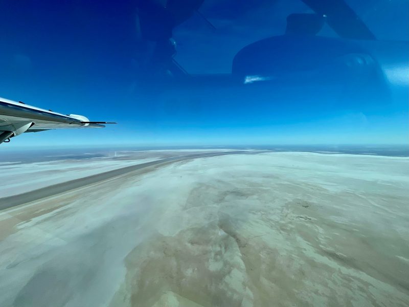
Floodwaters are only half the picture though, and tropical weather systems, often from Western Australia, can cross the country to bring local heavy rain to northern South Australia, including over Lake Eyre itself. The shape and profile of the lake quickly pools a lot of this water at the south-western corner of Lake Eyre North, known as Belt Bay.
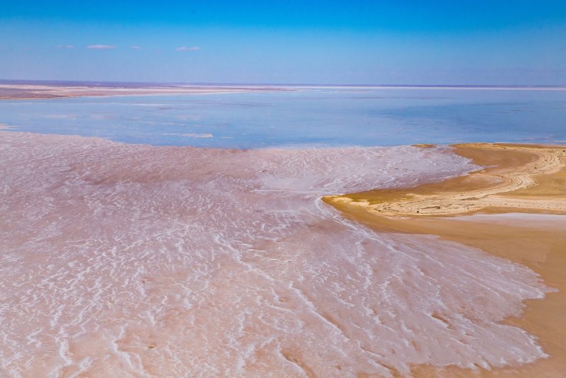
The challenges of a dry landscape and evaporation quickly follow any heavy rain, and so local rainfall rarely causes the widespread flooding that many people visit Lake Eyre for. But, rainfall often leaves the lake with significant standing water for several days and can produce some stunning conditions, particuarly on Lake Eyre south which rarely sees floodwater except in the major flood years.



How does the floodwater get to Lake Eyre?
For floodwater in the north of the Lake Eyre basin, the journey to Lake Eyre is long. Locally, rainfall drains into two major river systems which then flow into Lake Eyre.
The Warburton River
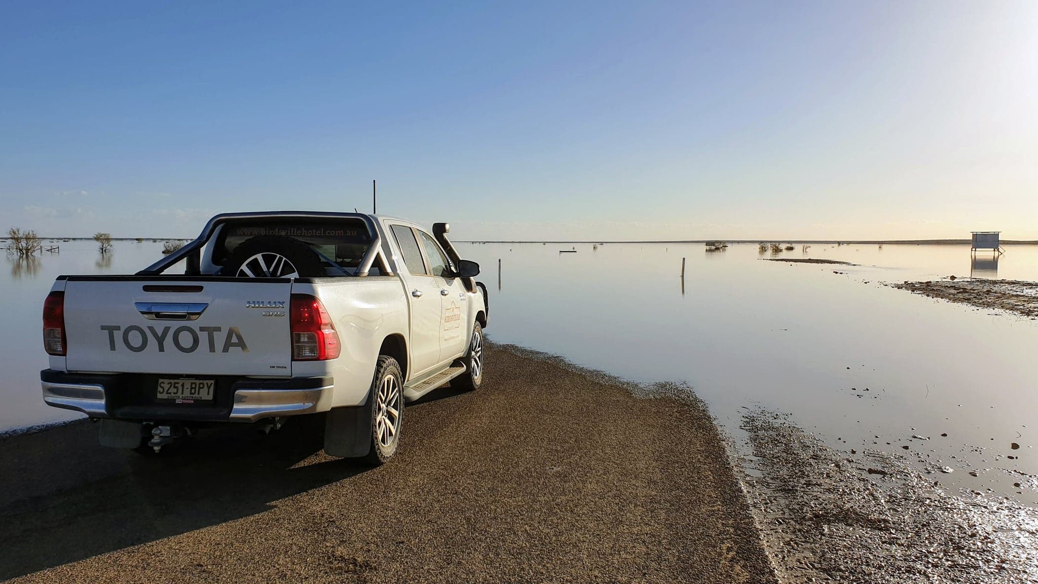
Far western Queensland has two river systems that flow into South Australia and eventually form the Warburton River - the Georgina and the Diamantina Rivers. These systems are responsible for the majority of flood events that reach Lake Eyre. The rivers meander through the landscape, spreading out under the force of flooding at several locations (the Diamantina Lakes north-east of Birdsville and Goyders Lagoon south of Birdsville) to become several kilometres wide.
The Cooper Creek
Coming back east from the Diamantina, the next river system is the Cooper. The Cooper flows further south and must cross the Strzelecki Desert in order to make its way all the way to Lake Eyre North. The Cooper rarely flows all the way through to Lake Eyre, having last done so in the 2009-2011 floods. The Cooper is still a remarkable waterway, and one many travellers will cross.
How does Lake Eyre flood?
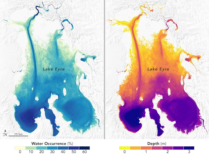
Lake Eyre itself has many parts. The inlets from the Warburton River are more than 100km away from the low point of Lake Eyre North at Belt Bay, and so even once water reaches Lake Eyre, its journey is still not over. As a result of this, a channel through the middle of Lake Eyre North forms known as the Warburton Groove, completing the journey from the inlet to Belt Bay.
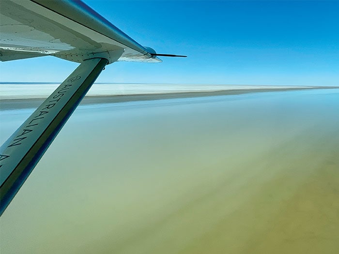
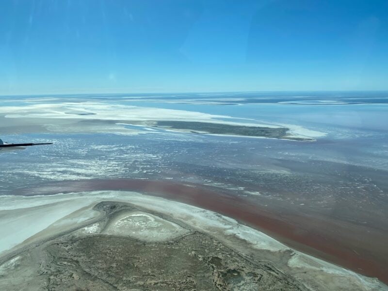
Once water flows all the way through to the low point in Belt Bay, the bottom of Lake Eyre North begins to fill and the depth slowly rises. Once Belt Bay fills to a depth of approximately 1.5m-2.0m, water is able to begin migrating to other parts of Lake Eyre North, and the south-eastern lobe called the Madigan Gulf fills. Once the southern half of the lake has near complete coverage, further flood waters typically spread further north - with coverage of the lake progressively increasing.
While all this happens, when depths are relatively shallow, surface winds can often blow water around the lake, overcoming the very shallow gradients to move water to parts of the lake that would not naturally recieve them. As a result, the lake often changes on a daily basis - providing a dynamic environment for even the pilots who see the lake several times a day.
When we talk about Lake Eyre, we typically use two metrics to quantify exactly how much flooding is going on. The first important metric is the depth of water at the low point in Belt Bay. The second is how much of the lake is actually covered with water. Typically when we start talking about the second - coverage - it means we're really in a significant flood year.

So what should you do with all this?
Well first up - if you ask us "Is Lake Eyre in flood?" - understand that the answer isn't just yes or no. It's complicated and nuanced, and is a question of depth and coverage.
Secondly - if you ask us "Is Lake Eyre going to be in flood?" - understand that it's even more complicated. It's so hard to predict how flood waters will travel through the landscape, even in the major flood years. There are just so many unknowns - how dry the landscape is, how heat and wind will imapct evaporation, how much local rainfall will supplement floodwater. The timeline for floodwaters to travel from Queensland to Lake Eyre is months.
Lastly - understand that seeing Lake Eyre isn't just about seeing Lake Eyre itself. The Lake Eyre Basin is massive, and fully appreciating it and understanding its signficance means going to see other parts of the basin as well. Many of our trips include a flight from Birdsville down the Warburton River to Lake Eyre, and in my view - this absolutely makes the trip. The changing landscape, from barren desert to green oasis to the massive expanse of Lake Eyre North - it's just stunning.
We also maintain an information page about water levels on Lake Eyre - it's updated by me with some help from our pilots on a regular basis. Do feel free to give us a call if you want to know more - 1300 206 130 will get you through to us.
Taste of the Outback (3-day or 4-day) is my personal favourite tour and is the perfect way to see the Lake Eyre Basin. It pairs these locations up with the Flinders Ranges for an outstanding outback experience.


About the author
Nick is Australian Air Safaris' Chief Pilot and has flown over Lake Eyre more than 40 times with tour groups. He has extensive experience flying in remote Australia, and has flown for Australian Air Safaris for more than 7 years. Nick previously worked for the Royal Flying Doctor Service flying aeromedical retrieval in Western Australia.


