Kati Thanda-Lake Eyre Water Level: Current Status
Kati Thanda-Lake Eyre Water Level: Current Status
Information on Lake Eyre - May 6th 2025
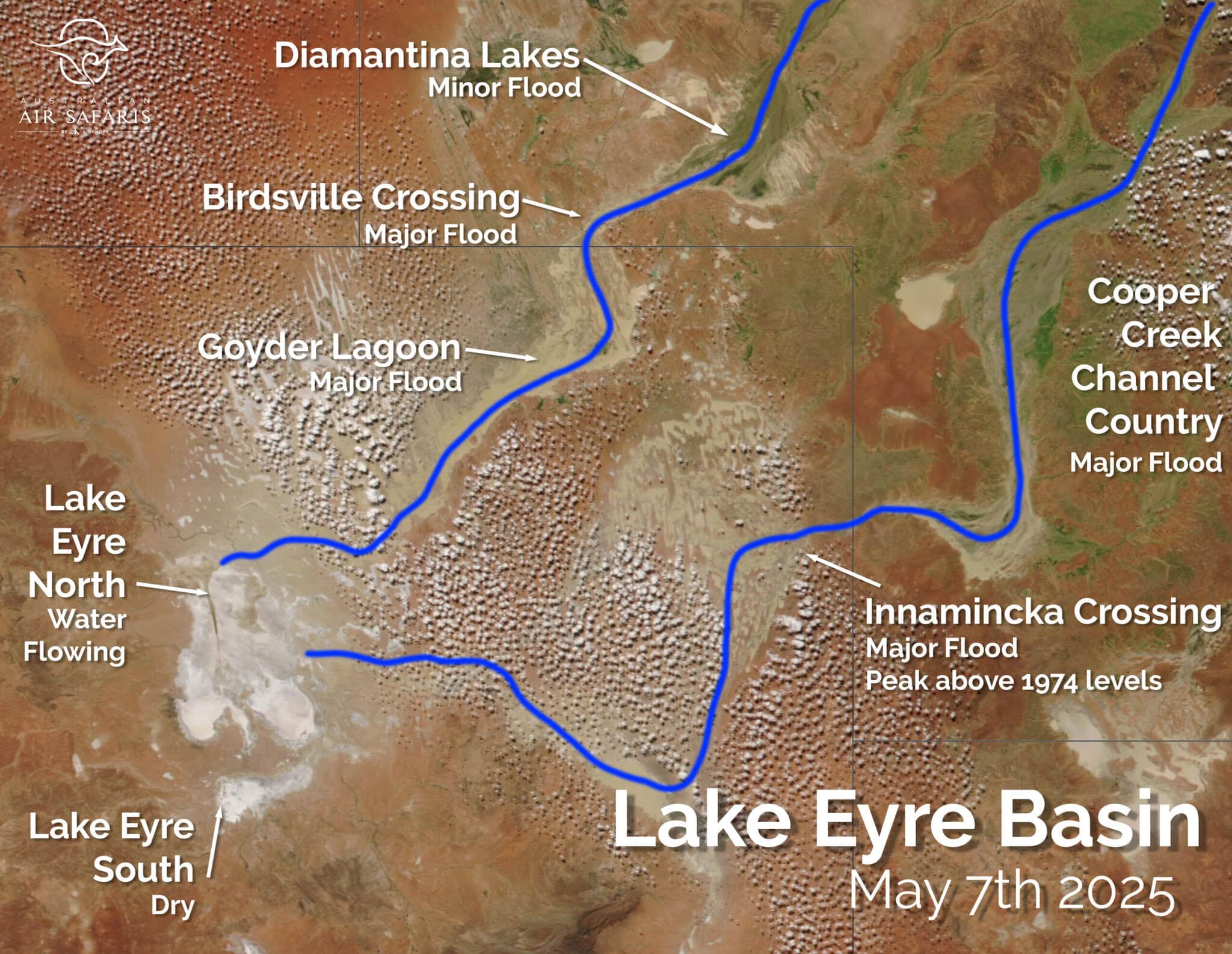
Widespread heavy rainfall from Tropical Cyclone Alfred has caused extensive flooding throughout central and western Queensland, with both the Diamantina and Cooper catchments recieving significant water. The Diamantina and Cooper are the two major water systems within the Lake Eyre basin which flow south-west towards Kati Thanda-Lake Eyre in South Australia.
Most notable is the amount of water travelling down the Cooper Creek, with Innamincka Township posting peak flood levels above the previous 1974 record. With further floodwater still flowing from south-western Queensland, it is highly likely that this waterway will connect to Kati Thanda-Lake Eyre and cause major flooding.
The Diamantina is also in major flood with waterways south of Birdsville filling with water as it flows south to Kati Thanda-Lake Eyre. 2024 was also a sigificant year in terms of water on Lake Eyre, so the basin as a whole is already relatively wet and green. It is increasingly looking like 2025 will be a record flood year for Kati Thanda-Lake Eyre.
Lake Eyre - Water Flowing | Warburton River - Major Flood| Goyder Lagoon - Major Flood | Birdsville - Major Flood | Diamantina Lakes - Minor Flood | Cooper Creek Channel Country - Major Flood | Innamincka - Major Flood, peak above 1974 levels
How to see Kati Thanda-Lake Eyre
Australian Air Safaris are the Kati Thanda-Lake Eyre experts having operated over 200 air safaris to the region. We visit Kati Thanda-Lake Eyre more than 20 times every single year with small group air tours. The following tours feature Kati Thanda-Lake Eyre with departures out of Sydney, Gold Coast and Melbourne:
News Flash 18 April:
We will be operating a 2 day tour and a 3 day tour to see the areas affected by the Queensland floods departing Melbourne in early May. These tours will be released Monday 21 April. If you would like to to receive details when they become available, email please email us at info@australianairsafaris.com.au.
As it happens: 2025 Lake Eyre Flood Event
Satellite images show first floodwaters in the Warburton Groove, Lake Eyre
May 2025
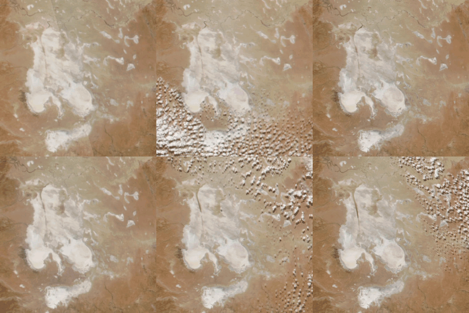
NASA satellite imagery shows the first water flows from south-western Queensland arriving at the entrance to Lake Eyre North, flowing down the Warburton Groove towards the low point at Belt Bay.
Belt Bay is the lowest point of Lake Eyre North, sitting 15m below sea level at the south-western corner of the lake. Significant further inflows of water are expected in the coming weeks.
Water begins arriving in Lake Eyre, major flood event expected
May 2025
Record flood levels in the Cooper and extensive flooding in the Diamantina are indicating a major flood event for Lake Eyre in 2025. Pilots Jacob, Keith and Tony provide an update on what's occurring and what we expect conditions to be like for 2025 on Lake Eyre.
Innamincka inundated by floodwaters
April 2025
The outback community of Innamincka, a stop on many of Australian Air Safaris' tours, has been cut-off by road with flood levels exceeding the 2014 and 2010 peaks.
Although Lake Eyre often floods with water from the Diamantina/Warburton rivers, flooding from the Cooper side is less common. Floodlevels in Innamincka indicate that there is sufficient water for the Cooper Creek to connect to Lake Eyre in 6-8 weeks.
Record Flood Levels in South-Western Queensland
April 2025
Communities south-west of Longreach, Queensland, set new records for flood levels, with many communities posting levels exceeding the iconic 1974 flood levels.
Locals have been devestated by the flooding, with properties and livestock destroyed. The river system is over 50km wide at the head of the Cooper, being fed by the Thomson and Barcoo Rivers.
Tropical Cyclone Alfred makes landfall
March 2025
Tropical Cyclone Alfred formed in the northern Coral Sea in late February 2025, eventually making landfall in south-eastern Queensland in early March. Although the system ended up having less impact than feared for coastal communities, the system then continued inland bringing widespread heavy rainfall throughout southern Queensland.
As it happened: The 2024 Lake Eyre Flood Event
Continued water coverage on Lake Eyre
July 2024
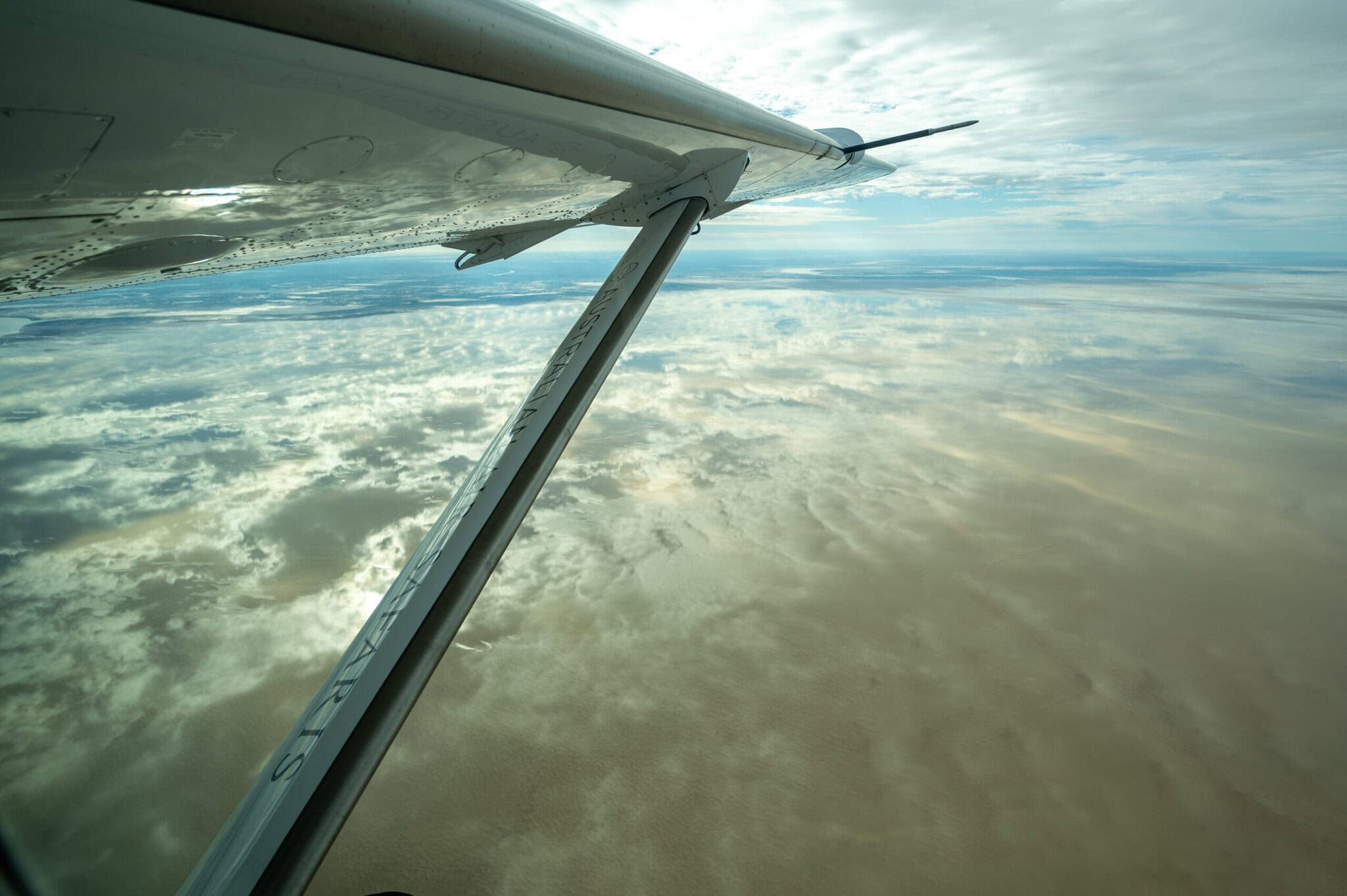
Lake Eyre continues to enjoy extensive water coverage, with several Australian Air Safaris trips each month visiting the area.
Cooler weather through the winter has limited the evaporation rate and produces still conditions that give the glassy, reflective surface seen in this photo.
Outstanding viewing over Lake Eyre
May 2024
Lake Eyre tours continue in May, with extensive coverage over Lake Eyre North and stunning viewing throughout the Lake Eyre basin. Bright green cuts through the red landscape as water diffuses into the landscape.
Pilots report continued flows throughout the Warburton and Diamantina Rivers, indicating further flows to Lake Eyre North over the coming months.
Good water coverage in Lake Eyre
April 2024
Several tours have visited Lake Eyre in April, and the conditions have been outstanding. The country between Birdsville and Lake Eyre is increasingly green and lush, with extensive water in the landscape. Most of Lake Eyre north has water coverage, except for the Madigan Gulf. No sightings of extensive bird life on the lake.
More tours are scheduled in May and June, and it's looking like the water will remain on the lake for the winter as conditions cool and evaporation decreases.
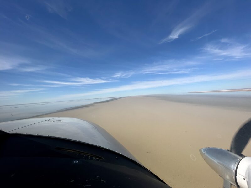
Water reaches Lake Eyre
Mid-March 2024
Water has started flowing into Lake Eyre North, arriving in mid-March and beginning to flow into the Warburton Groove, a channel that runs from north to south down the lake towards the low point at Belt Bay.
This video was shared by our friends at Wrightsair in William Creek and shows the first trickles beginning to reach the dry lake bed.
Goyders Lagoon Flooding
Late February 2024
Satellite images from NASA show floodwaters passing through Goyders Lagoon at the end of the Diamantina River. Here the river spreads out to kilometres across, inundating the landscape and making for some amazing viewing from the air.
Most importantly - the water reforms at the south-western end of Goyders Lagoon into the Warburton River. From here it travels another 200 kilometres to reach Lake Eyre North and begin flooding the lake itself. This process will take several more weeks and it is expected to arrive there in April.
Satellite Timelapse- Diamantina Lakes
Early February 2024
Located just north-east of Birdsville, the Diamantina Lakes are part of the Diamantina River system which flows from south-western Queensland south into South Australia towards Lake Eyre. Satellite images over the 20th January through 13th February 2024 shows this flood changing the landscape.
These satellite images show the scale of the flooding as well, and flooding in the north of the Lake Eyre basin is a fantastic sign that water will flow to the south of the basin and eventually to Lake Eyre later in the season. How much water makes it through to Lake Eyre itself will depend on the conditions over the coming months.
Floodwaters passing Birdsville
Mid February 2024
The team at the Birdsville Hotel captured some fantastic footage of the flood waters flowing down the Diamantina through Birdsville. Birdsville is south-west of the Diamantina Lakes area and downstream.
Birdsville is one of our favourite spots to visit with more than 20 visits each and every year on our tours. It's a fantastic spot to see where the water that flows into Lake Eyre is coming from.
Ex-Tropical Cyclone Kirrily
Early February 2024
In early February Tropical Cyclone Kirrily formed in the Gulf of Carpentaria and eventually tracked south into western Queensland. This system has brought significant rain including some to the Lake Eyre basin, which is now causing flooding in the Diamantina and Birdsville areas.
How does Lake Eyre flood?
Exactly how Lake Eyre floods is a little bit complex. Nick Stobie, our Chief Pilot, has flown over Lake Eyre more than 40 times and has put together a detailed explanation on how Lake Eyre floods.
We get asked the question 'Is Lake Eyre going to flood?' often - understanding how it floods is important to understanding how we answer this question. Importantly, we're talking about an extensive landscape with many influences on how water travels through it - evaporation and local rainfall can dramatically change how flood waters progress through the basin.
Once the lake is in flood, we then begin talking about two metrics - depth (in Belt Bay, the lowest point of Lake Eyre North) and coverage (how much of the lake is covered).
Pilot Callum talks about Lake Eyre
Callum is one of our amazing Touring Pilots and has extensive experience flying over Lake Eyre. It's one of his favourite spots and one that he loves sharing with guests on our tours.
Views from the 2023 season
2023 was a really dynamic year on Lake Eyre - some minor floods throughout the year that made it all the way south. We were really lucky to host so many trips out to the lake, it's really a priviledge to share this unique landscape with guests.
Join us for memorable flights over Lake Eyre
Dry or wet, Kati Thanda-Lake Eyre is a sight to behold. Tours to outback Australia are what we do, and with more than 40 years experience - there's no-one better to take you to see iconic Lake Eyre.
Every seat is a window seat, and our pilots are experienced travellers who are passionate about sharing uniquely Australian experiences with each and every one of our guests.
Check us out on Tripadvisor to hear a bit more about what our guests say about their visits to Lake Eyre.


